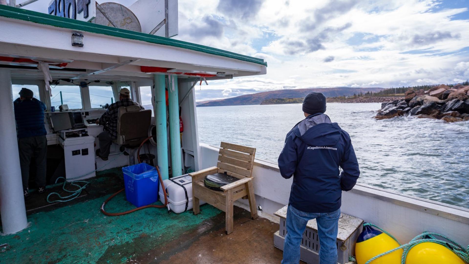
Cape Breton Northern Tip Charters
Region: Cabot Trail
Community: North Highlands
Private charter of the coastline of the ruggedly beautiful Cape Breton Island, based in Bay St. Lawrence. Come join us on the water for you...

Beulach Ban Falls
Height: 21 m
Distance (one way): 134 m
Difficulty: Easy
Elevation: 12 m
Hiking Time: 5 minutes
Cellphone Coverage: No
National Park fees apply
Finding the Trailhead: From Cape North, drive on the Cabot Trail heading south west for 11 km. Turn left onto Beulach Ban Falls Road. Drive 2.2 km to its conclusion. Park here
Trailhead: 46º48’53.4”N, 60º37’35.3”W Waterfall: 46º48’50.8”N, 60º37’30.9”W
The Hike: From where you parked, a dirt road leads almost to the foot of this waterfall. Where the road ends, a short walk of 10 m is all that is required to reach its base. With such a short hike to the base of the fall, this waterfall destination is meant for just about anybody.
Watch the waterfalls in the Aspy Valley below you as the river winds its way to the Atlantic. The name “Beulach Ban” is Gaelic, a language spoken by the original Scottish settlers. When you reach the base of the mountain, you can drive to the falls. This is a particularly nice area in the autumn when the foliage changes colour. A small picnic area allows for a tranquil lunch.
Region: Cabot Trail
Community: North Highlands
Private charter of the coastline of the ruggedly beautiful Cape Breton Island, based in Bay St. Lawrence. Come join us on the water for you...
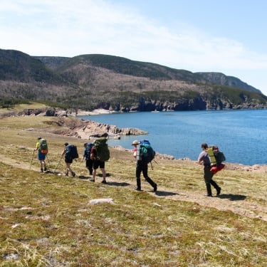
Region: Cabot Trail
Community: North Highlands
Length: 16 km (10 mi) return Hiking Time: 5+hr Type of Trail: natural surface, compacted earth Uses (no snow): walking, biking, horseback ri...

Regions: Cape Breton Highlands National Park, Cabot Trail
Birders and other nature lovers will enjoy the varied wildlife on this short relaxing trail, following the shoreline of a small man-made lak...

Region: Cabot Trail
Community: Pleasant Bay
Roberts Mountain is a 3.9 kilometer out and back trail located near Pleasant Bay, Nova Scotia, Canada that offers scenic views and is good f...
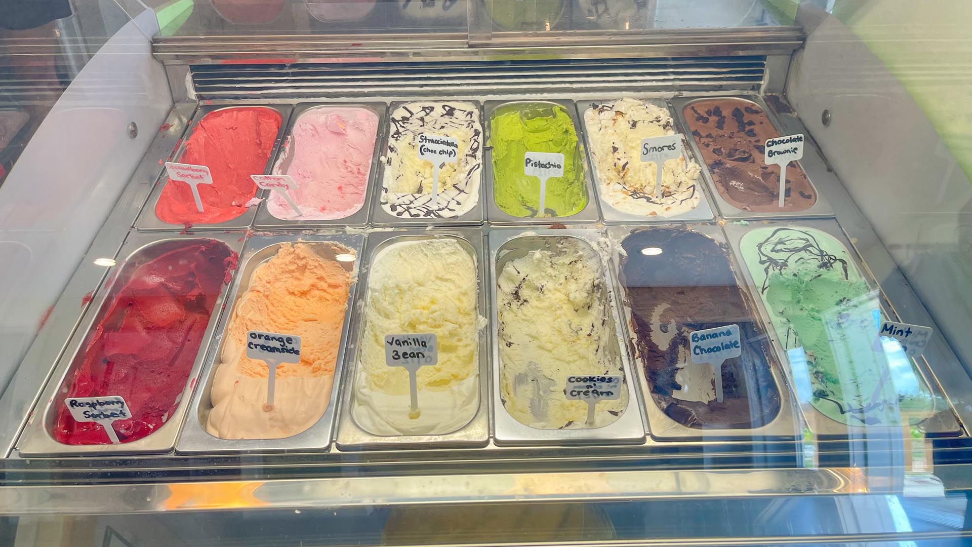
Region: Cabot Trail
Community: Ingonish & Area
Our handmade artisan gelato is made primarily with cows’ milk, but we typically have some goat milk varieties available for more adventuro...

Region: Cabot Trail
Community: Ingonish & Area
Cabot Trail Biker Brew, it’s kick stands down! Daniel (Cabot Trail Biker) has a hard time keeping this brew in stock! This brew is pro...
Canada's Musical Coast, nestled along the western shores of Cape Breton Island, offers some of the most breathtaking sunsets in the country.
Snowmobiling offers exhilarating experiences across winter landscapes, but safety must always be a priority.
Atlantic lobster from Cape Breton Island is renowned for being the freshest and some of the tastiest lobster in the world.
Tap your toes to fiddle tunes at a Ceilidh. See authentic Acadian crafts at Les Trois Pignons. Take a piece of Mi’kmaq culture home with you at a drum-making workshop. On Cape Breton Island, culture is all around you just waiting to be explored!
When the adventurous duo Chris and Jan from A for Adventure received the call to explore Cape Breton Island’s magical Waterfall Season, they packed their gear, laced up their boots and set their sights on some of Nova Scotia’s most breathtaking scen
Cape Breton Island Ambassadors Davey and Sky were selected by Explore Canada as official ambassadors for their home province of Nova Scotia.
Cape Breton Island Ambassador Ashley George was selected by Explore Canada as an official ambassador for her home province of Nova Scotia.
When Cape Breton Island dons its blanket of snow, it transforms into a winter wonderland bursting with adventure and serene beauty.


